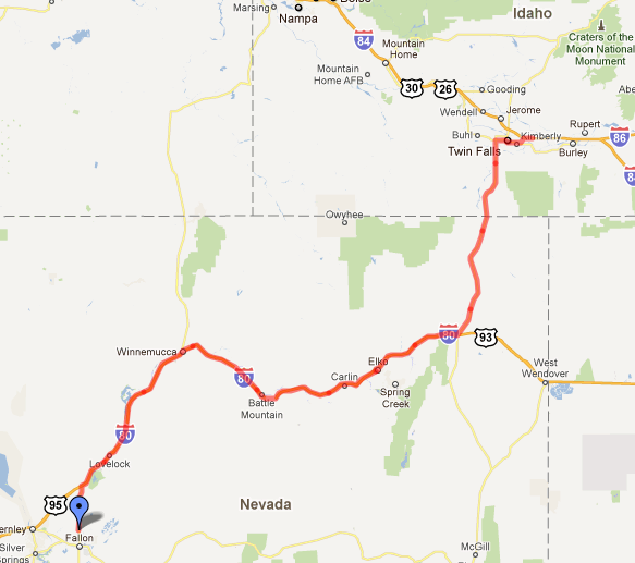
The original route planned by Dinky for crossing Nevada was route 50, also called “America’s Loneliest Highway”. Named so because of the many miles of nothingness that it crosses, without a single town to pass through (save ghost towns). Fortunately he was able to be convinced that route was a bad idea to take. The lack of cellphone signal and the endless desert vista was going to be too much to bear. Traveling east via interstate 80 was not much more enjoyable but at least it was faster. Nevada is a stunningly boring land, where roadkill is the only diversion. At Wells we turned north on rt.93 as our visit to the Teton National Forest and Yellowstone was set for the next day. Idaho was only a sleigh improvement over Nevada. Gone was the desert only to be replaced by vast fields of potatoes and road construction.
 Total Distance: 724.97 km (450.5 mi)
Total Time: 8:52:54
Moving Time: 6:37:44
Average Speed: 81.62 km/h (50.7 mi/h)
Average Moving Speed: 109.36 km/h (68.0 mi/h)
Max Speed: 139.71 km/h (86.8 mi/h)
Min Elevation: 1112 m (3647 ft)
Max Elevation: 1879 m (6165 ft)
Elevation Gain: 2625 m (8613 ft)


